

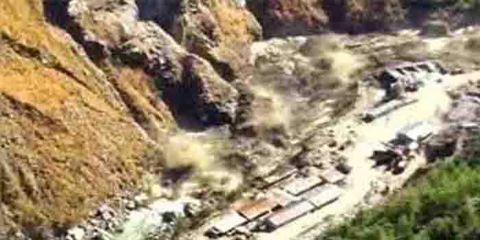
High resolution satellite images have identified the exact spot where a “dangerous” lake was formed by the debris of the avalanche that left dozens dead and 200 missing on Sunday. Scientists of the Defence Research and Development Organisation(DRDO), the National Disaster Response Force (NDRF) and others are working on a plan to avoid another disaster, should water from this lake gush through a breach.
Choppers have taken videos of this artificial lake, which is thrice the length of a football field. The satellite images indicate the block on the Rishi Ganga that is fed by the fast-flowing Ronti River. A part of a glacier broke off and crashed into the river, picking up boulders, debris and massive amounts of silt as it slid down the Rishi Ganga river sweeping away two hydel plants along its path. The exact cause of the flash flood which ripped through two hydel projects is not clear, but it may have been triggered by an avalanche. A close-up from Wednesday shows the extent of the water build-up and the wall of debris. A report by the Wadia Institute of Himalayan Geology says that the debris brought by it has blocked a stream that joins the Rishiganga, leading to the formation of a temporary lake.
The worry is that the weight of the water can pierce the wall, which could lead to another flood. If breached, the new lake could cause further damage in the valley, the report said. Though experts have said that there is no immediate threat of the lake busting, panicked residents have started spending nights in the open forests.


